
Welcome to the Rancocas Creek Water Trail
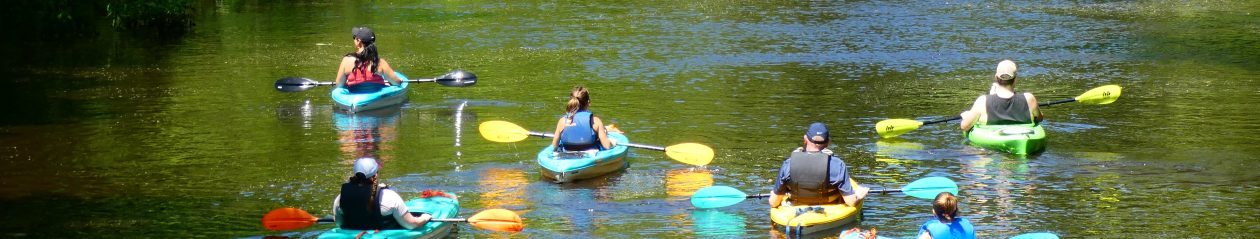
The Rancocas Creek Water Trail is a 80 mile (128 km) long tidal and non-tidal multi-use water trail connecting people to the Rancocas Creek’s natural environment, its 400 years of maritime heritage and to the communities and creek towns it touches in the Mid-Atlantic’s Southern New Jersey. From the Pine Barrens National Reserve headwaters to paddling on bucolic, placid non-tidal flat-water to paddling on open tidal waters, a variety of paddling and multi-use experiences awaits you. From kayaking, bird-watching, canoeing, fishing, relaxing, camping, hunting and just floating down creek to motorized vessels and jet skis on the Rancocas tidal reaches follow the Rancocas Creek Water Trail to learn what others already know: The Rancocas Creek is a gem, Hidden from Plain Sight.
“What Stands Out” is a partial list of year-round activities and places to visit inside the Rancocas Creek Watershed and are easily accessible from the Water Trail, proper.
Click here for maps of the water trail, creek front communities and other areas to explore and discover.
What Stands Out ?
360 square mile watershed
North Branch
Southwest Branch
South Branch
Glacier Geology
Native American Sites
Non-Tidal
Tidal
1 of the 4 major watersheds of the NJ Pine Barrens and National Reserve, the only watershed that flows West.
400 years of America’s maritime heritage
1.5 hours South of New York City
15 miles from Philadelphia
80 miles of water trails
34 communities Rancocas Conservancy Municipal Map
14 river towns
Baseball Mud
Regional Market
Post-Industrialization Renaissance
“Ghost” Towns and the Jersey Devil
County Seat
Mt. Holly, since 1677, head of Tide, 39 National Historic Sites
Revolutionary War Battles and Skirmishes
Underground Railroad
Timbuctoo
“Jersey Fresh” Agriculture, Annual Farm Fair
Mt. Holly Mill Race, Oxbow and Flood Channel
6 portages
Fossils
5 camping areas and opportunities
10 canoe and kayak livery’s
Annual Canoe Festivals and Paddle Events
Pine Barrens “Cedar” water. Amber, reddish brown, tea colored
5 interpretative nature centers
Fishing
6 Burlington County Parks Check out the online interactive map
NJ State Forests and State Parks
Wharton State Forest – South/SW Branch Headwaters
Brendan Byrne State Forest – N Branch Headwaters
Whites Bog State of NJ Historic Village (Annual Blueberry Festival)
New Jersey Pine Barrens National Reserve (Headwaters)
Tidal Segment Flows into the Delaware River and Estuary
Texas Phosphorous Plant
NJ Permitted Hunting and Trapping
Willingboro – Shipyard, Mill Creek, Ferry’s, Graveyard of Tugs and Barges, Annual Jazz Festival
Swamp Poodle, Main Stem, Riverside
Delanco Crossing and Hawk Island
Marina’s
Delaware River and Estuary
Tide-Water Ecology
Delaware River Pennsylvania Water Trail
Water Connection to the Ports of Camden and Philadelphia
Year Round Climate

N Branch Mt. Holly High Tide